Information
- Location
- Zhambyl Region, Korday District
- Period
- 4000 BCE – 0
- Type
- Petroglyph
- Kind
- Archaeological sites
- Protected zone
- ✓
- Authors
- Железняков Борис Анатольевич
Sources
- Қазақстанның киелі орындарының географиясы: Табиғат, археология, этнография және діни сәулет өнері нысандарының тізілімі / Жалпы редакциясын басқарған ҚР ҰҒА академигі Байтанаев Б.Ә. – Алматы: Ә.Х. Марғұлан атындағы Археология институты, 2017. – 1-шығарылым. – 904 б.
Description
From the early Bronze Age to the present day. The complex was first opened in the late 1950s by P.I. Marikovsky. It has been studied since 2000, when it was reopened by R. Sala and J.-M. Deom. It is protected by the state.
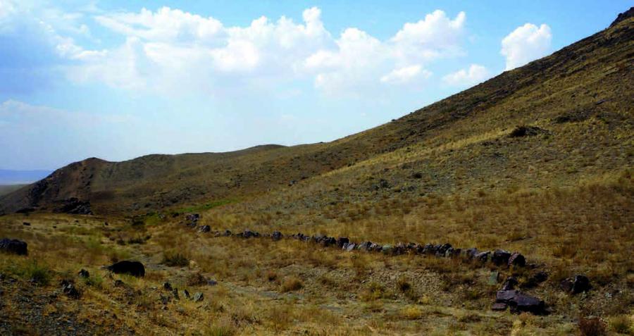
The archaeological complex is located in the landscape of the Kulzhabasy Ridge, on its relatively steep slopes with a southern exposition (descending to the valley of the Kopa River). They border the southern edge of the Shu-Ile (Aytau) mountains and abound in water springs. It is located in the Korday district of Zhambyl region on the border with the Almaty region; the studied area (1-26 gorges and six gorges of Kostobe) - 230 km on the road from Almaty, 10-40 km from Otar to the west, 80 km north of Bishkek. Adjacent to the railway stations of Anrakhai and Kordai and together with the extension of the Kostobe Ridge is 29 km long. The landscape of Kulzhabasy is 3-3.5 km wide, it has its own laws of location of monuments: petroglyphs and settlements are located in the mountainous part, the last - at springs, burials are located at the exits from gorges (bronze), as well as on watersheds (early Iron Age) up to the upper part of the ridge.
This is one of the largest petroglyph-archaeological complexes in Kazakhstan with a huge number of multi-temporal settlements, shelters, burials and places of worship, stone calculations of various purposes. The number of petroglyphs is inferior to Eshkiolmes, but not the value of the totality of images. The Bronze Age is the most popular by the number of petroglyphs. Among the drawings there are images of bulls, including those with solar symbols on the body, "sunheads", adorants, carts, scenes of hunting, rituals (in masks) and sacrifices, large planes with multi-figure compositions, for example, more than 30 images of bulls of different sizes, other types of images of the "celestial herd", as well as multi-temporal "pictures of the world". In several gorges, an early layer of petroglyphs is distinguished: images of grids, various signs, including "dumbbells". The petroglyphs of the Sak time are unique: "births" at the boiler with vertical handles, two knights with a full set of weapons, deer of the early Saka time, etc. The Hun-Xianbian period is remarkable for its mass, and there are also unique images, in particular unicorns, roe deer, transferred in the "Chinese animal style", the Chinese chariot. There are many "sheep" - farns, which do not have any artistic value, but mark the time of special reverence for this image. The petroglyphs of the Turkic period are unique and relatively numerous: horsemen with a banner, scenes of fights, hunting and others, two runic inscriptions were found, numerous tamga signs were found. In addition, the preservation of economic and ritual calculations of buried megaliths, irrigation structures, in particular dams, which will help trace the traditions of land use over more than four thousand years of history, is unique.
The variety of monuments here is just impressive: Neolithic blanks at the creek, dozens and hundreds of large and small sites of petroglyphs, settlements, burial grounds from the Bronze Age to the present, hydraulic structures for agriculture. Unique are Turkic epigraphic monuments and property signs carved here on the rocks, as well as Arabic inscriptions used before the 1920s, and funerary and memorial monuments of the Kazakhs of the last 300-400 years of unique preservation, located on the lands, which now belong to their direct successors of the family. Tamgas (tanba) of the Botpai and the Seikim clans are carved everywhere near the settlement sites, in the upper gorges. Very soon, some works of art (?) of the middle - second half of the XX century will acquire the status of a monument, and sometimes they also have author's signatures.
Undoubtedly, this complex unites a huge layer of multi-temporal petroglyphs into a single whole, which makes it actual and distinguishes it from hundreds and thousands of other similar cultural landscapes, where petroglyphs are absent or have no such outstanding value. The preservation of Kulzhabasy's petroglyphs is also unique. In Kulzhabasy - Kostobe (on the surveyed part) 14,851 drawings on 2,461 planes (by R. Sala and J. -M. Deom) were taken into account, most likely, not all the images were counted (far), as many tens and hundreds of images are hardly noticeable only at a certain illumination* [In the central gorge of Tanbaly 3,200 petroglyphs were counted, which were carved out on 516 planes. In addition, there are numerous hollows in different parts of the central gorge periphery - about 2,000 more images. In the neighboring, compact Karakyr, according to S.A. Potapov, about 6,000 petroglyphs were found on more than 900 planes. In the Akkaynar area of 70 km2, 6,100 petroglyphs were punctured according to L. Hermann].
This huge number of petroglyphs of Kulzhabasy and the Shu-Ilei Mountains requires research, documentation, presentation, protection and management of this heritage. Difficulties lie in the fact that a part of the Kulzhabasy complex (Zhambyl region) and Akkaynar (Almaty region) are separated by the military training ground "Otar". In addition, the lands represent private property. At the same time, it is planned to carry out a series of works to prepare the nomination of the Kulzhabasy complex for World Heritage. The heritage of Kulzhabasy is absolutely unique: nature, landscapes, archeological objects reflecting different stages of human society development history. Many of the names of gorges (toponyms) that have survived to this day, keep information about the very old past.
Rock art "binds" all these components and maximally "determines" the unity of the complex from the point of view of ancient and medieval inhabitants of Kulzhabasy. Its preservation is also unique. The sacral significance of a certain image carved out on the rock for the ancient worldview is enormous. It is the subjects, signs and images significant for spiritual culture that were knocked out in each particular case. They distinguished the sacral landscape developed by society from the undeveloped natural landscape.
The species of separate gorges is unique, in which the life boiled, judging by the huge number of settlements and burial grounds, on the banks of the dried stream now. At the same time, there are no petroglyphs on the rocks of the huge hill, as we believe, because of the hardness of the rock. But the inherent sacralization of the space required an external design of the cultural landscape, it was renewed by megaliths - huge boulders, obviously, they were also informed of some sacred power. Thus, on the example of separate gorges of Kulzhabasy one can better understand both the nature of sacredness of different epochs and its external design.
Kulzhabasy has a significant number (7) of "sunheads", but that is especially valuable for revealing the genesis of this image of the whole Central Asia, there is a significant number of anthropomorphic disks "on legs", on a stand, as well as bronze mirrors, both separately and in the hands of people. This can be interpreted as discs that took part in the solar cult rites of the Bronze Age. Such images, reflected on the rocks, obviously precede the stage of adding the iconographic image of the "sun-head". In terms of number and diversity, it is difficult to compare the images of Kulzhabasy with any other monument in the region. Therefore, Kulzhabasy is the most important monument of the fine arts of Zhetysu, where the image of the "sun-head" was created and formed, and this place is undoubtedly sacral.