Information
- Location
- Түркістан облысы, Sozak District
- Period
- 901 – 1800
- Type
- City
- Kind
- Archaeological sites
- Authors
- Байпақов Карл Молдахметұлы
Sources
- Қазақстанның киелі орындарының географиясы: Табиғат, археология, этнография және діни сәулет өнері нысандарының тізілімі / Жалпы редакциясын басқарған ҚР ҰҒА академигі Байтанаев Б.Ә. – Алматы: Ә.Х. Марғұлан атындағы Археология институты, 2017. – 1-шығарылым. – 904 б.
Description
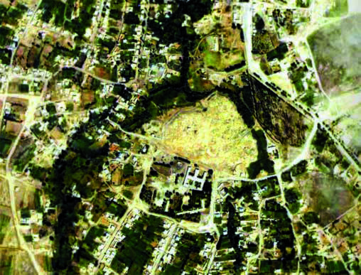
The hillfort is located to the south of the modern village Suzak on a high natural hill, which is washed by a small river (Suzak district, SKR) from the north and partly from the west. The height of the hill is from 15 to 35 m. The hillfort is divided into three sites in a row. The highest of them is medium: up to 35 m high and 200×350 m in size.
This city was first mentioned in the middle of the XIII century in the events related to the trip of the Armenian king Getum I to the khan Munke. Having reached the Karakorym, Getum I was accepted by the great khan "and is honored with dignity by him". "He stayed in the Horde for fifty days, (khan) granted him a decree with a seal, so that no one dared to oppress him and his country; he also granted a letter of commendation, which freed the church everywhere (from taxes)". Returning, the embassy of Getum I drove through the cities of Hutukhchin, Pergant, Sukhulkhan, Urosokhan, Kaikant, Khuzak (Kamots), Hendakhor and Sgnakh to the mountains of Kharchuk. It also passed through the towns of Sgnakh and Savran, which is very large, (then) Kharchuk and Ason in Savri and Otrar, Zurnuk and Dizah. From there, on the thirtieth day they reached Samarkand..." In these names it is easy to recognize the cities known from other written sources: Sugulkent, Kumkent, Suzakh, Karachuk, Yasy, Sauran, Otrar, Zernuk. They are quite confidently identified with specific hillforts. It is at this time that the Silk Road section along the northern slopes of Karatau becomes busy.
In the events of the second half of the XV - first half of the XIX centuries Suzak is often mentioned as a city on the northern slopes of Karatau, from where the road led north to Desht-i Kypchak and south to Sygnak, Yasy, Otrar, Central Asia, west to the Aral Sea and east to Taraz. Suzak often passed from hand to hand during the Kazakh and Shaibanid wars. Thus, in the message of Ruzbikhan, "in the Suzak ditch" the Shaibanids defeated the army of Zhanibek's son Mahmud-sultan, and then, together with the people of Suzak and Karakoz on the Sogunluk pass, through which the road from Suzak to Sygnak was going, once again defeated the army of Burunduk Khan. In 1743-1745 Suzak together with the cities of Turkestan, Sauran, Otrar was governed by Kazakh khan Abulmambet.
Filipp Nazarov, who made his trip in 1814-1815, gives interesting information about Suzak and settled settlements of Kazakhs in the gorges of Karatau mountains: "We found quite a lot of turtles on the way (to Suzak). (At the end of September) at dawn the caravan stopped 4 versts away from the city. I and the officials and sultans were invited to the ruler or governor of the city; he treated us to tea, grapes, melons, and smoked tobacco, and then allowed us to see the city. Suzak includes from 500 stone houses, built so tightly one to another, that entering the street, you think to see it fenced with a stone fence; windows in the houses are built (in general) in the courtyard, in the whole city only one round street. This city stands on an elevated place, in the yard surrounded by a high stone wall, inside abounds with keys, up to 200 people garrison guards the city. In its suburbs there are arable land and scattered yurts of poor Kyrgyz: residents of hard-working, engaged in bread-growing and produce a change of goods with Kyrgyz wandering on Sarys and Chuya" [cited from: Nazarov, 1968, p. 31]. After F. Nazarov went with a caravan along the northern slopes of Karatau to the south-east and through "Chulakkurgan" and further towards Arys and Chimkent. He writes about Karatau: "We met in this place Kyrgyz (Kazakhs), who have stone fortifications from robbers' raids and black (wild stone) Kyrgyz, near which cultivated fields and mobile yurts are visible. They are engaged in bread-growing, selling bread to passing caravans for goods. In dangerous cases, they hide old men, wives, children and cattle in their fortifications, protecting them to the last drop of blood" [cited from Nazarov, 1968, p. 32].
In 1829-1830 Suzak was mentioned by N.I. Potanin, who accompanied the Kokand envoy, as a large city on the trade route from Siberia to Central Asia. At that time caravans were going through "Cholak-Kurgan", which, as N.I. Potanin writes, was 100 versts from Turkestan and 20 versts from Suzak. Three decades later (1859) the translator of the collegiate registrar N.I. Bardashev characterizes the road from the town of Aulie ata to Suzak, which ran along the gorge Karaoi to the valley of the Assa River and then went to the northern slopes of Karatau, brought to Cholakkorgan and from there 55 versts to Suzak. In Suzak district there were several cities and fortresses. Yilan-Karaul is mentioned in connection with the events of the campaign of Abdallah in Turkestan and Desht-i Kypchak.
The location of the medieval Suzak is determined, because its ruins still retain the old name - the hillfort Suzak. The upper layers of the hillfort date back to the XVI-XVIII centuries. Judging by the ceramics collected in the debris of the hillfort, the monument of the I - XVIII centuries is dated to. Of course, Suzak is one of the cities of the Kazakh khanate as a sacral center. On the hillfort there are mausoleums of Kazanshy ata, Azhe-ata, Karabura, Kulak ata revered by the people. They are cult buildings where pilgrims come.These mausoleums, as well as the most revered hillfort of the population, are among the sacred places of Kazakhstan.
The most revered is the mausoleum of Karabura. According to the local legend, this monument is erected over the grave of the close associate of Khoja Ahmed Yasawi. In the recent past, a new mausoleum was built.