Information
- Location
- Kostanay Region, Amangeldi District
- Period
- 1200 BCE – 100
- Type
- Geoglyph
- Kind
- Archaeological sites
Sources
- Қазақстанның киелі орындарының географиясы: Табиғат, археология, этнография және діни сәулет өнері нысандарының тізілімі / Жалпы редакциясын басқарған ҚР ҰҒА академигі Байтанаев Б.Ә. – Алматы: Ә.Х. Марғұлан атындағы Археология институты, 2017. – 1-шығарылым. – 904 б.
Description
It is located 15 km east of Ushtogay village (Amangeldy district, Kostanay region). The Ushtogay square is the most famous among the "geoglyphs" of Torgay.
For the first time the information about the objects, which later got the name "Torgay's geoglyphs", has been received at the general meeting of the Orenburg scientific archival commission in 1909 in the report of B.A. Skalov, which message is resulted in I.A.Kastanye's work "Antiquities of the Kyrgyz steppe and Orenburg territory". B.A. Skalov reported on the presence within the first Naurzum parish of "...barrows, located in a row, forming geometric figures like triangles and quadrilaterals ... are located at the same distance from each other" [Kastanye, 1910, p. 64].
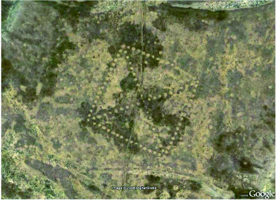
In 2007, while studying the space images available in Google Earth, Dmitry Dey found a number of geometric objects formed by barrow-shaped embankments, the most famous of which is the Ushtogay square. Subsequently, as a result of archaeological and geophysical research by the staff of the archaeological laboratory of the Kostanay State University named after A. Baitursynov, the entire complex under the name of the Ushtogay square was revealed. The complex includes: the square itself, three circular ditches on the northern side of the square, a line and a barrow on the southern side of the square.
Ushtogay square represents a figure in the form of a square with the designated diagonals (101 embankments, diameter 10-12 m, height up to 1 m). The length of the square side is 287 m, the diagonal length is 406 m. Orientation on the sides of the world object is given on the diagonals of NNW-SSE, NWW-SEE. One of the embankments was subjected to archeological excavations, as a result of which no structures or finds were found.
Ushtogay line 55 m long consists of seven earthen embankments built in a row with a diameter of 7-8 m and a height of 0.2-0.3 m; it is oriented along the line of N-S. The barrow has a diameter of 22 m and a height of 1 m. The circular ditches are 20 m in diameter, up to 2 m wide and 0.05 m deep.
Studies of the Ushtogay square allowed archaeologists to preliminarily classify this complex as a ritual-sacral object that existed between the final Bronze Age and the first centuries of our era. The odd number of embankments, perhaps of symbolic, sacral importance, does not contradict this assumption. In the mythological notions of many peoples, the odd and even is a contraposition of male and female, right and left, top and bottom, heavenly and earthly.
It is a monument of archeology. The object of pilgrimage and tourism.